Our pick
Lion's Head or Table Mountain
The tour on this site
- Meeting pointVaries by option
- Rating4.9 from 2,127
- Pricefrom $44
Guides
Language
Currency
View availabilityfrom $44 · free to cancelWhere is your stop
Lion's Head or Table Mountain guided hike
★ 5.0 · Rated by 2,127 guests
Look at 10 stops
Choose a route and tap a pin or stop to see its note and open it in Google Maps.
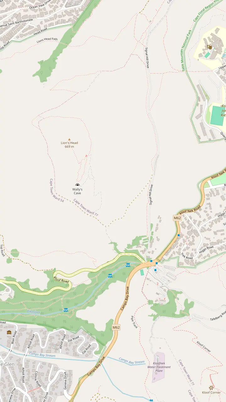
The listing puts the summit at 669 m above sea level, and Cape Town Tourism says the top gives 360-degree views.
Google MapsDrivers go up Kloof Nek, turn toward Signal Hill and park where indicated, and the trail starts from there.
Google MapsThe cave is closed to the public and is not a path sanctioned by SANParks.
Google MapsMyCiTi tells riders to take the bus to the Kloof Nek stop for the Table Mountain shuttle.
Google Maps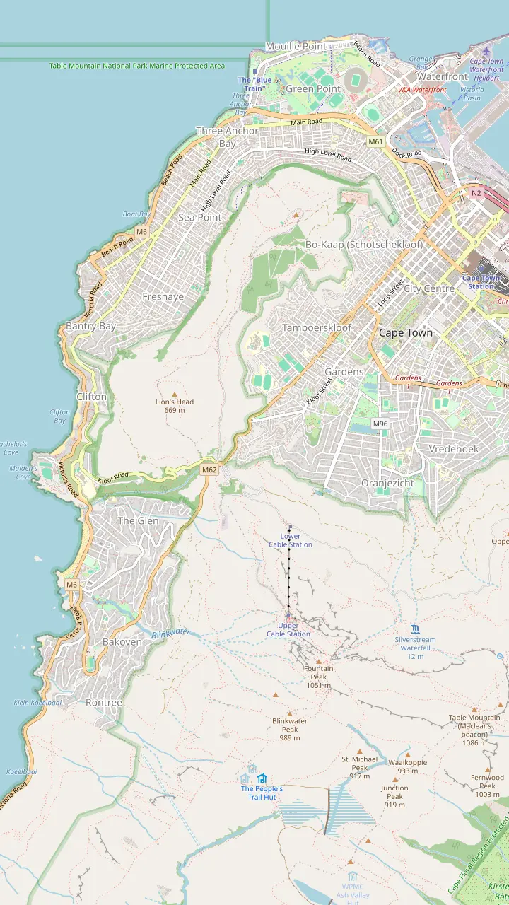
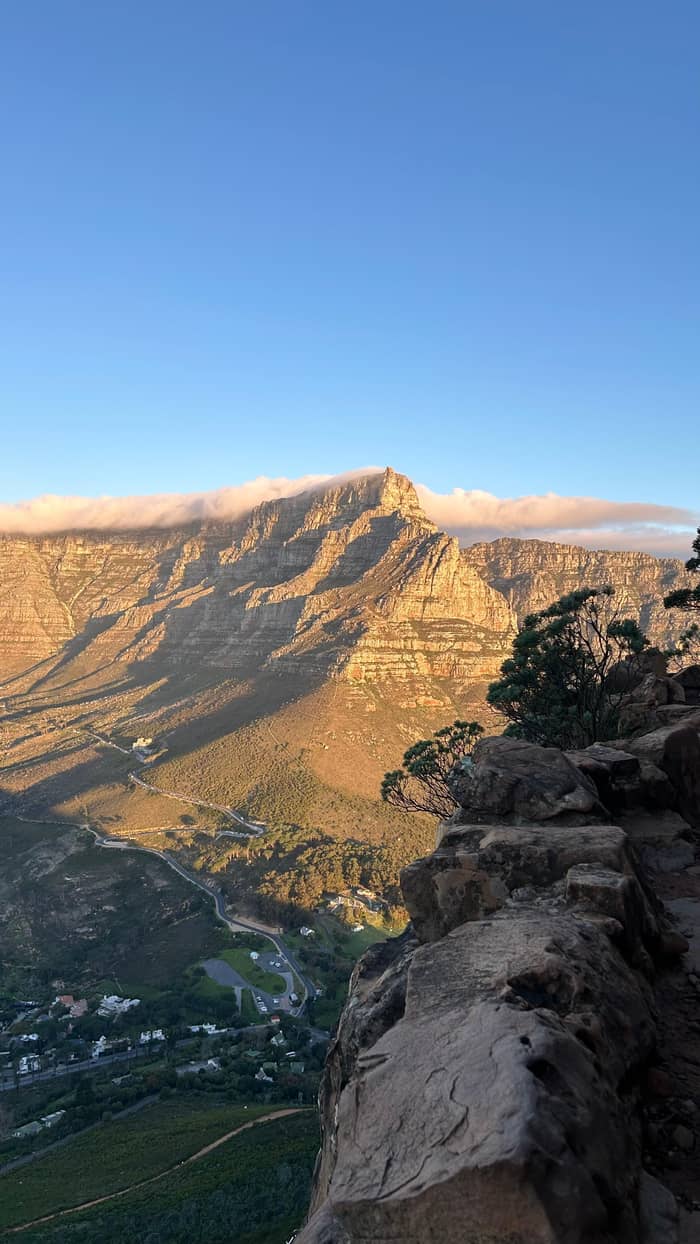
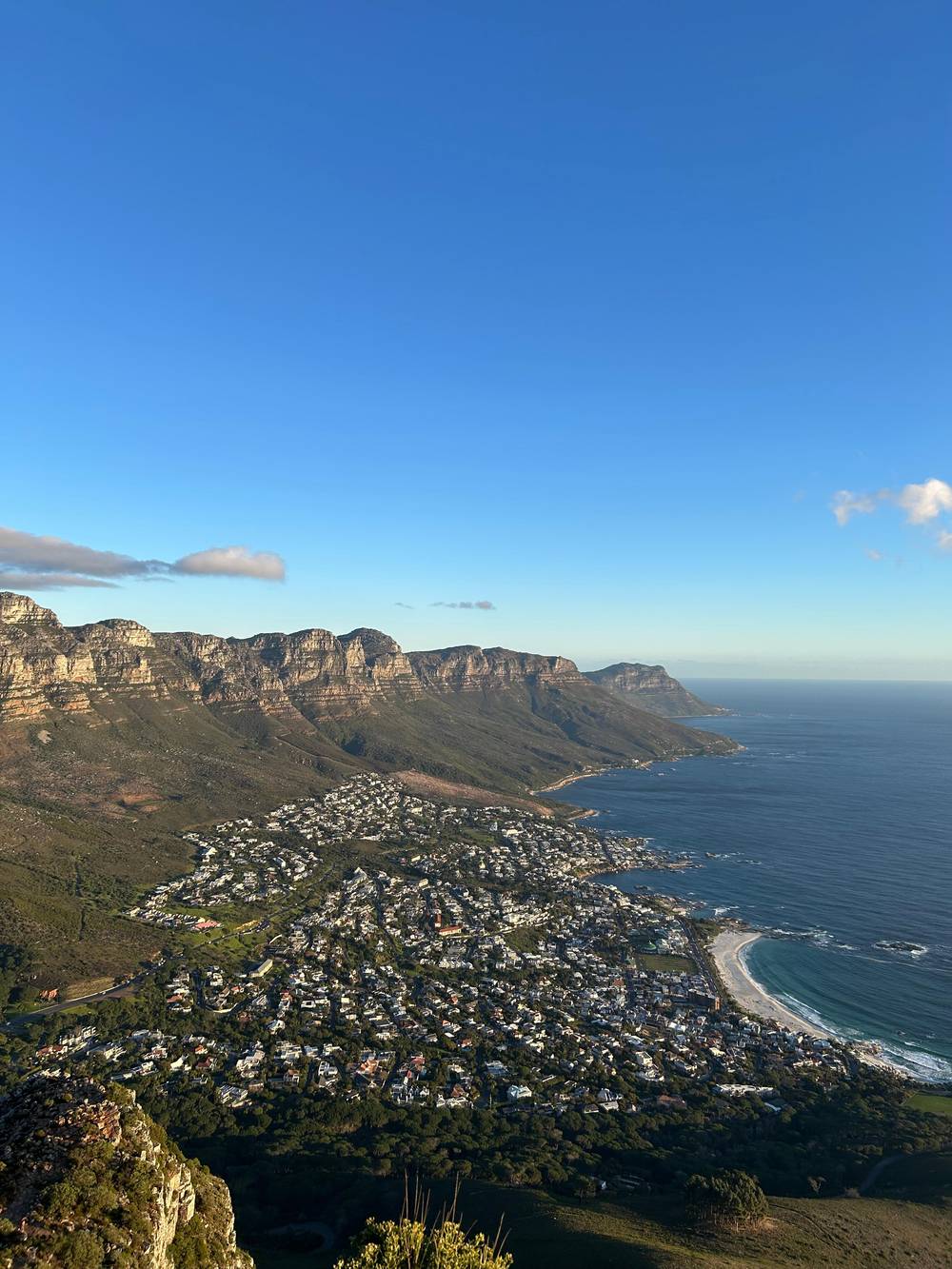
From the peak there are panoramic views of the city, Table Mountain, Camps Bay, Signal Hill and the Twelve Apostles.
Google MapsSignal Hill is free, and visitors are told to arrive early to secure a spot.
Google MapsAt the top of Kloof Nek, Camps Bay is ahead, Table Mountain is on the left and Signal Hill is on the right.
Google MapsOn the Atlantic side, Kasteelspoort is the easiest route up Table Mountain, with views of Camps Bay.
Google MapsCable cars leave the lower cable station on Tafelberg Road every 10 to 15 minutes.
Google MapsPlatteklip Gorge is one of the most popular routes up Table Mountain, a prominent gorge up the centre of the main table.
Google MapsMapping data © OpenStreetMap contributors
The trailhead, the pebbled track, the spiral path, the ladder and chain section and the easier bypass, placed on a map with the times and distances that go with them.
Editorial team, lionsheadhike.top · Updated November 7, 2026 · A 7 min read
Main facts
The Lion's Head trail starts just off Signal Hill Road, and Cape Town Tourism lists the location as Signal Hill Rd.2,6 To find it from the city bowl, drive up Kloof Nek towards Table Mountain. At the top you see Camps Bay ahead, Table Mountain on your left and Signal Hill on your right, and you turn right toward Signal Hill and park where indicated.7,8,9 On the map above, the car park pin and the Kloof Nek pin mark that approach.
Read the map in two layers. The trail panel shows the foot of the mountain: the summit, the car park, the closed cave and the bus stop at Kloof Nek. The city panel zooms out to the neighbouring landmarks so you can see where Lion's Head sits between Signal Hill and Table Mountain. Table Mountain is flanked by Devil's Peak and Lion's Head, so from the city the peak reads as a shoulder of the bigger mountain.10
The name is older than the trail. The Dutch dubbed the peak Leeuwen Kop before it became Lion's Head, and the shape does read as a lion rising over the city if you squint.11 You do not need to see a lion to follow the route. A newcomer needs only a short list from the map: where the path begins, where it turns steep, and where the choice between the chain ladder and the bypass comes.
Pin by pin
| Point | Where | What the source says | Use it for |
|---|---|---|---|
| Car park | Signal Hill Road | Park where indicated9 | The start |
| Jeep track | Above the car park | A pebbled track past a boom12 | Warming up |
| Paraglider launch | Along the track | Watch people jump off13 | A pause |
| Ladder section | Below the summit | Steel ladder and chain handrail14 | The scramble |
| Bypass | South-east ridge | An easier route round the chain ladder5 | A calmer line |
| Wally's Cave | Off the main path | Closed to the public19 | Avoid |
| Summit | Top of the peak | 360-degree views15 | The view |
Positions come from OpenStreetMap where the place is mapped; the facts in the third column come from the cited sources.
The walk begins gently. Cape Town Tourism says it starts past a security boom and up the pebbled jeep track, an easy meander before the hike proper.12 The advice is to take your time and enjoy the scenery. This early part is where you settle your pace and decide whether the group is walking together, and it is the stretch where the city views begin to open up behind you. Use it to loosen the legs, drink some water and let slower walkers join the group before the path steepens.
Along the way there is a paraglider launch point, where you can watch people throwing themselves off a mountain.13 It is a natural place for a pause and a photograph, and it shows how steep the slope is below the flight line. A separate article by the same tourism body notes that Signal Hill, the neighbouring peak, is where paragliders may also be seen jumping off the mountain.16 Stand well back from any edge while you watch, and keep children close.
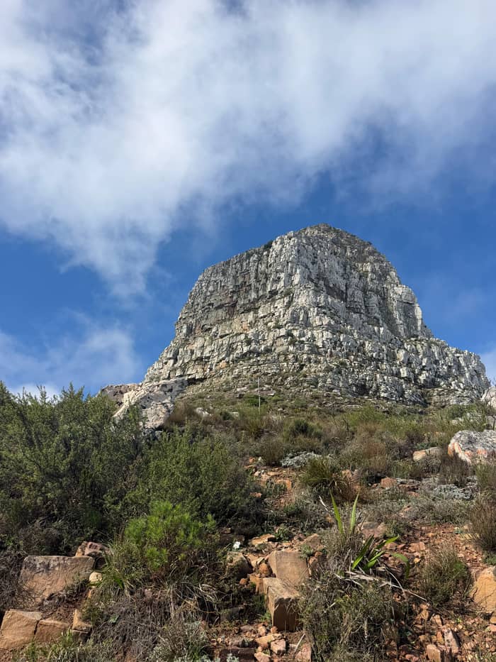
Higher up, the path starts to climb. Cape Town Tourism describes the trail as spiralling around the mountain, offering ever-changing views, before a short but steep scramble to the summit.3 The spiral is what makes the route readable on a map: you circle the cone rather than climbing straight up it. Expect the surface to change from track to path to rock, and expect to use your hands on the last section.
The last part of the route is where hikers slow down. To reach the panoramic views you climb a steel ladder, negotiate a chain handrail and, if you feel adventurous, cross a chain ladder before the summit.14 Another Cape Town Tourism article confirms there are ladders and chains to assist you near the top.4 On the map this is the short, steep end of the spiral, just below the summit pin.
Not everyone wants the chain ladder, and the route allows for that. Cape Town Tourism says you can bypass it by an easier route up the south-east ridge.5 A winter hiking article adds that there is an alternative footpath if you do not feel like waiting for the crowds to climb up.21 The sources do not describe the bypass in detail, so ask at the foot of the section or follow a guide who knows it, and do not guess at a line on loose rock.
One place is not a route at all. Wally's Cave is closed to the public and is not a path sanctioned by SANParks, so Cape Town Tourism says to stick to the safest routes.19 It appears on the map for orientation only, as a warning pin. Treat any side path that does not look maintained the same way, and stay on the main trail until the summit. If you are unsure whether a path is the official one, turn around and ask another walker or your guide.
Pick your line
Choose the line that matches you and the answer sits beside it.
If I want a gentle first look
Walk the Lion's Head Loop
The loop is a 5.26 km trail around the base with a gentle slope.20
If I want the summit
Take the spiral path
The trail spirals around the mountain before a short, steep scramble.3
If Chains worry me
Use the bypass
The chain ladder can be bypassed by an easier route up the south-east ridge.5
If I want to avoid the crowd
Ask about the alternative footpath
An alternative footpath exists if you do not want to wait for the crowds.21
If I want something longer
Look at Table Mountain
Platteklip Gorge takes 1 to 3 hours and India Venster 2 to 4 hours.17,18
Where guides meet
Our pick
The tour on this site
Trail start
Limited to 8

Car park start
Car park start
The numbers are modest, which is part of the mountain's appeal. Cape Town Tourism lists the hike at 5 km with a moderate difficulty, and says it takes about 90 minutes to 2 hours depending on your pace and how often you stop to take photographs.1,2 The summit, according to the site tour's listing, is 669 m above sea level. Use these figures to plan your Lion's Head hike route, not to race it, because the ladders slow everyone down.
If you want a flat alternative, there is one. The Lion's Head Loop is a 5.26 km trail that circles the base of the mountain, with a gentle slope that suits trail running beginners.20 It is a way to see the mountain from every side without going up it, and a good option for a rest day or for a group with mixed fitness. On the trail map the loop is the line around the foot, while the summit route is the spiral that climbs through it.
For comparison, Table Mountain's Platteklip Gorge route should take between 1 and 3 hours depending on fitness, and India Venster can take between 2 and 4 hours.17,18 Lion's Head sits at the short end of that scale. That is useful when you are choosing between the two peaks for a morning or an evening. The route is shorter and quicker than either Table Mountain line, though the ladders make it more than a walk.
Stage by stage
Approach
Drive up Kloof Nek, turn toward Signal Hill and park where indicated.9
Start
The walk starts past a security boom and up a pebbled jeep track.12
Viewpoint
A paraglider launch point lets you watch people jump off the mountain.13
Spiral
The trail spirals around the mountain with ever-changing views.3
Ladders
A steel ladder and a chain handrail lead up, with a chain ladder as an option.14
Summit
360-degree views take in the city, ocean, Table Mountain and Robben Island.15
From the summit the view is wide. Cape Town Tourism says Lion's Head offers panoramic views of the city, Table Mountain, Camps Bay, Signal Hill and the Twelve Apostles Mountain Range.23 Another article adds 360-degree views, with Robben Island laid out below.15 The city panel of the map puts those places in order for you, so you can name each one when you reach the top. Bring the map up on your phone before you leave the car park, because the summit is a poor place to start working out which peak is which.
Beside Lion's Head, the neighbouring routes have their own pins. Platteklip Gorge is a prominent gorge up the centre of the main table of Table Mountain, one of the most popular routes up the mountain.27 Kasteelspoort, on the Atlantic side, is the easiest route, with views of Camps Bay.25 The lower cable station on Tafelberg Road has cars leaving every 10 to 15 minutes.26 Signal Hill is free, and the advice is to arrive early to secure a spot.24
The Lion's Head trail in Cape Town is free to walk, and Table Mountain National Park is primarily open access, with conservation fees at only a few points such as Cape Point, Boulders, Kirstenbosch and Silvermine.31 That makes the map a planning tool rather than a ticket office. You can look at the pins, pick your day and start walking, as long as the weather is kind and your group has the right shoes.
Video
Lekker Walk - Virtual Tour Guide on YouTube · Your tap on play is what loads the video.
The trail spirals around the mountain, offering ever-changing views, before a short but steep scramble to the summit.
On the trail
If you book a guided hike, the meeting point is usually the trailhead. One listing gives it as the start of the Lion's Head trail at 5 Signal Hill Rd, next to a cafe van, and another as the start of the trail at 5 Signal Hill Road. Another says the Lion's Head car park on Signal Hill road, next to the coffee truck, in the afternoon only. The site tour's listing says its meeting point varies with the option booked, and that pickup from accommodation can be chosen.
Whatever the start, the packing list is short. Cape Town Tourism's Table Mountain guidance includes trail running shoes or hiking boots, a small hiking backpack, a water bottle of at least 1 l, a cap or hat, sunglasses, sunscreen and a charged power bank.32,33,34,35 Cape Town's tap water is generally safe to drink, so you can fill the bottle before you set off.36 On Lion's Head, add a warm layer if you are going up for sunset, because the trek down after sunset can get chilly.37
Finally, check the weather before you drive up. The weather on the mountain can change very quickly, regardless of the season, and the advice is to look the day before and the morning of the hike.38,28 If visibility is poor, do not continue climbing and find a spot that offers some sort of shelter.30 A map is only as useful as the visibility you walk it in, and a clear view of the next ladder is worth waiting for.
FAQ
Sources
Related guides
Wondering how hard Lion's Head is? A real person answers here.